| Georgia's Geology > Physiographic Provincess> Map of Provinces > Georgia's Aquifers | |||
|
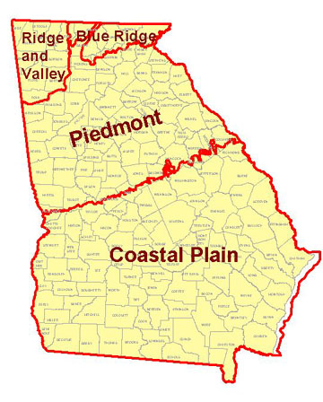
Geology is the study of the Earth, the materials it is made of, the changes that have taken place since its origin, and the processes that caused those changes. Rivers are affected by the geology and topography of the areas they flow through, because the slope of the land and the soil and rocks determine how fast water flows, how much of it soaks into the ground, how much runs into river and stream channels, and how quickly the rocks and soil erode. The eroded soil and rock are carried downstream until they settle out in a calm stretch of the river or until they reach the ocean. Water which soaks into the ground enters the groundwater system, and may help recharge one of the aquifers underlie the surface soil. Georgia is divided into 4 geological regions or physiographic provinces. The geological history of each province is unique and has led to the features and topography present there today. For more information on Georgia's geology and the geologic provinces follow this link: http://www.gly.uga.edu/GAGeology.html |
 |
|||
| Click on the map to see a larger version. | ||||