| Georgia's Geology> Physiographic Provincess> Map of Provinces > Georgia's Aquifers | |||
|
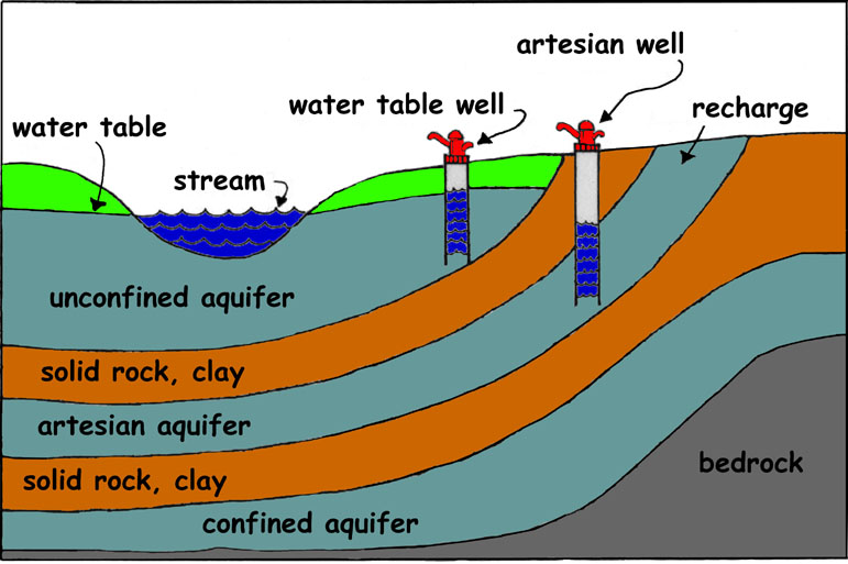
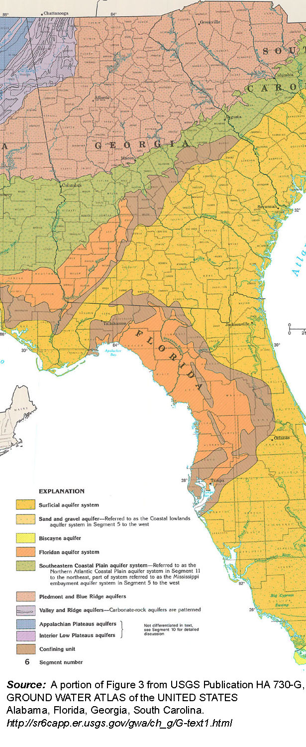
An aquifer is an underground layer of rock or soil that contains water. The water is held in the spaces between the rock or soil particles. There are two kinds of aquifer: 1. a confined aquifer is a water supply which is sandwiched between two layers of soil or rock that water can not pass through (impermeable layers), and 2. an unconfined aquifer is a water supply that has an impermeable layer below it, but not above it. A confined aquifer that is under pressure is an artesian aquifer. The pressure can often push water to the surface in a well drilled into an artesian aquifer; usually wells need a pump to bring water to the surface from the aquifer they are drilled into. We use aquifers as a source of drinking water and of water to irrigate crops or to use in industry, pumping water from the aquifer using a well. As with any container of water, pumping from the aquifer empties it--or at least decreases the amount of water it holds. Aquifers are refilled, or recharged, in areas where they are exposed on the surface of the earth. Water can re-enter the aquifer in these recharge areas. There are several aquifers that are important for Georgia. Above the Fall Line, the primary aquifer is the crystalline rock Piedmont and Blue Ridge aquifer. Between the Fall Line and the coast, there are three principal aquifers, the Southeastern Coastal Plain Aquifer, the Floridan Aquifer and the Surficial Aquifer. The Floridan Aquifer is heavily used for drinking water and industrial purposes by Georgians who live in the Coastal Plain. The United States Geological Service (USGS) has a site with useful information about aquifers: http://ga.water.usgs.gov/edu/earthgwaquifer.html
|
 |
||||
| Click on the image to see a larger version. | |||||
 |
|||||