| page last updated |
| Georgia's River Basins | Georgia's Geology | Georgia's Climate | Altamaha River Basin | ||
| Altamaha Basin > Hydrology > Water Quality > Environmental Threats > Human Impacts > Cultural Features > Coastal Habitats > Tributaries > Plants > Animals > Sapelo Island | ||
|
General
Interest Site |
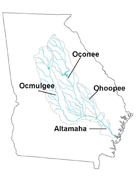
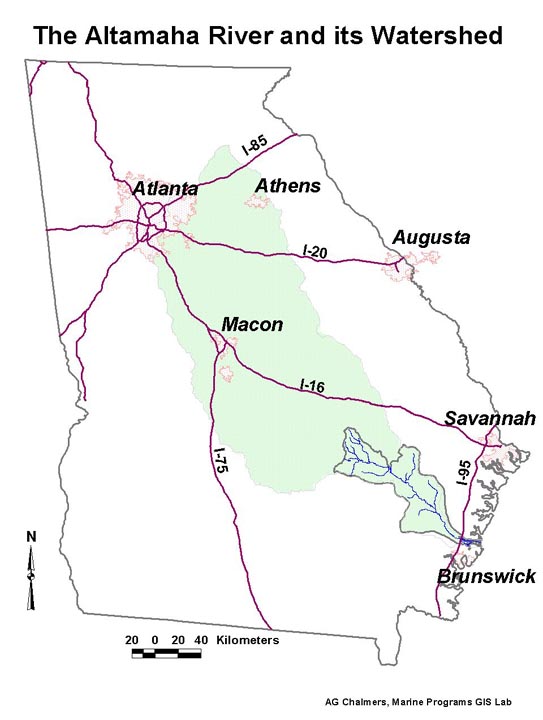
The Altamaha River, formed by the confluence of the Ocmulgee and Oconee Rivers in southeast Georgia, drains nearly one quarter of the state. The watershed of the Altamaha and its tributaries encompasses the cities of Athens, Macon and Milledgeville and parts of Atlanta, stretching from the Upper Piedmont to the Lower Coastal Plain.
It flows into the Atlantic Ocean near Darien at about the mid-point of Georgia's coastline, carrying millions of gallons of fresh water, nutrients and sediments to the estuary and coastal area every day. The river and its floodplain swamps and marshes are among the most undisturbed habitats in the state, although increasing population in the Coastal Plain and pressure for development are threatening their pristine nature.