| page last updated |
| Georgia's River Basins | Georgia's Geology | Georgia's Climate | Altamaha River Basin | ||
| Altamaha Basin > Hydrology > Water Quality > Environmental Threats > Human Impacts > Cultural Features > Coastal Habitats > Tributaries > Plants > Animals > Sapelo Island | ||
|
General
Interest Site |
| A Wide River and Floodplain | ||||||||
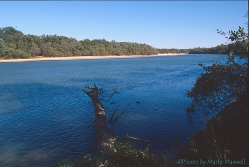 |
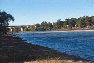
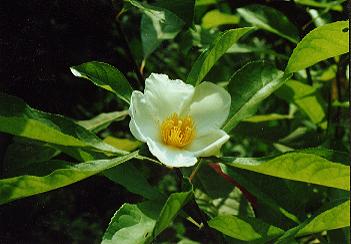
The Altamaha River below the confluence of the Oconee and Ocmulgee Rivers near Hazelhust, GA is wide and winds through Georgia's Lower Coastal Plain. Although it moves steadily, it moves slowly in comparison to its flow through the Piedmont. The flood plain of the river is also broad and relatively flat, with 170,000 acres of river swamps adjacent to the river and sand ridges bordering the swamps. Only 5 bridges cross the river in the 137 miles between the confluence and the coast. The area is home to at least 130 species of rare or endangered plants and animals, including seven species of freshwater mussels found nowhere else in the world. William Bartram, an eighteenth century naturalist who explored the Altamaha and its tributaries found there a species of flowering tree, Franklinia alatamaha, that hasn't been seen growing in the wild since he collected examples of it in 1770. |
|||||||
 |
||||||||
 |
||||||||
| <— Upstream | Downstream —> | |||||||