Altamaha Basin > Hydrology > Water Quality > Environmental Threats > Human Impacts > Cultural Features > Coastal Habitats > Tributaries > Plants > Animals > Sapelo Island |
||
|
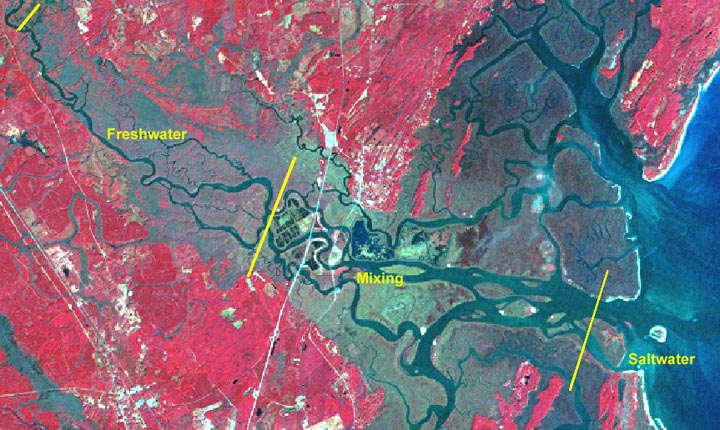
An estuary is a place where freshwater from a river mixes with saltwater from the ocean. The estuary of the Altamaha River is in Glynn and McIntosh Counties in southeastern Georgia and occupies an area of about 45.25 square kilometers (km2). Three quarters of that area is the mixing zone where fresh water flowing from upland Georgia meets and mixes with salt water from the Atlantic Ocean. The remaining parts of the estuary are the saltwater area at the mouth of the river and the tidal freshwater area, at the upstream end of the estuary, which is beyond the reach of salt water but is affected by the same tides which mix the fresh and salt water in the lower reaches of the river. In the tidal portion of the river, the water level rises and falls twice a day in rhythm with ocean tides, and the flow of freshwater slows as seawater is pushed into the mouth of the river. |
||||
 |
||||
| Click on the image for a larger view. | ||||