Altamaha Basin > Hydrology > Water Quality > Environmental Threats > Human Impacts > Cultural Features > Coastal Habitats > Tributaries > Plants > Animals > Sapelo Island |
||
|
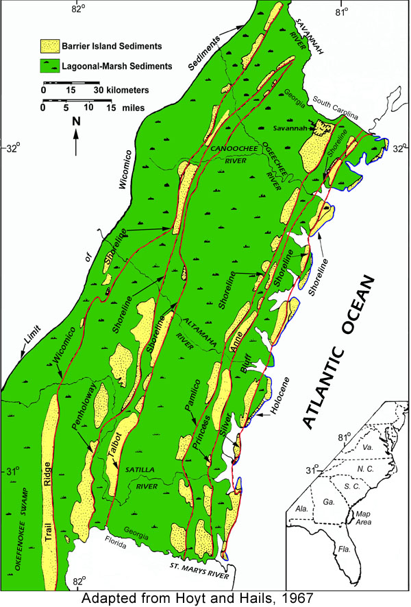
Georgia's 13 barrier islands were formed 30,000 to 40,000 years ago when wind, wave action and long-shore currents moved sand and other sediments to form a dune or beach ridge near the ocean shore. Rising sea level eventually flooded the area behind the dune, creating the band of marshes and tidal creeks that are present today between the barrier islands and the mainland. This same process occurred several times along the Georgia coast as sea level rose and fell during Ice Ages and interglacial periods. The Altamaha crosses six ancient shorelines as it flows to the sea (Hoyt and Hails, 1967). |
 |
||||
|
More information on barrier islands Island sediments Sand-sharing system Sapelo Island |
|||||
| Click on the image for a larger view. | |||||